We all know Manchester is brimming with history. But a lot of us won’t realise that as you commute to or from work, meet up with friends or nip to the shops, there’s so much of the past right beneath your feet.
A few months ago, we came across the Manchester Libraries Archive, a huge online database of images of the borough, with some photographs centuries old. It’s fair to say we spent a good afternoon scrolling through – it’s fascinating to see how our city streets have evolved to suit the time they’re in – or, not changed at all.
First up, Stevenson Square. The bustling heart of the Northern Quarter, this area of conservation is home to some of the city’s most vibrant businesses, from hairdressers to art shops, bars to lifestyle stores, it’s usually where you’ll find us enjoying a lunch time pint.
Let’s rewind to the early 1700s. At this time, the area we now know (and love?) as Piccadilly Gardens was home to the daub holes – boggy clay pits where early Mancs would dig for the material to build houses. In the mid-18th Century, the land between these old daub holes and Ancoats Lane was owned by Sir Ashton Lever (a prominent Georgian collector of natural objects).

Due to pressure from property developers, Lever eventually sold the land to property developer William Stevenson. The 1700s was a pivotal century for Manchester – going from a small market town to a hub of the blossoming textile industry, thanks to canals linking Manchester to the port of Liverpool and thus opening the opportunity for global imports. According to local censuses, the town had 23,000 inhabitants in 1773, but just under 30 years later, the population tripled to over 70,000 people – and it did that again before the 1830s.
Mr Stevenson aimed for the site (which now encompasses most of the Northern Quarter) to rival the fashionable St Ann’s Square. This didn’t happen, and he slowly sold the land to various entrepreneurs. Its commercial potential flourished, and a plethora of businesses and warehouses popped up alongside private houses along the neighbouring streets. By the 1830s, the area looked a lot like it does today, with red-brick buildings home to a variety of businesses and workers.
Fast forward to the latter decades of the 19th century, the square was a popular spot for open-air speakers, congregations and processions. Most of the private houses were converted to commercial properties, and it became an even bigger hive of business as the city dominated the textile industry.
100 years later, after the opening of the Arndale centre, the square slowly lost its retail charm. Now, you’ll find shops like Fred Aldous and Unitom, but the buildings are dominated by hospitality ventures – bars, pubs and cafes.
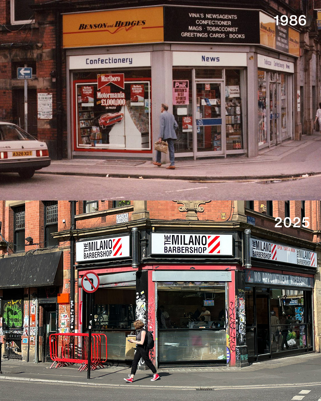
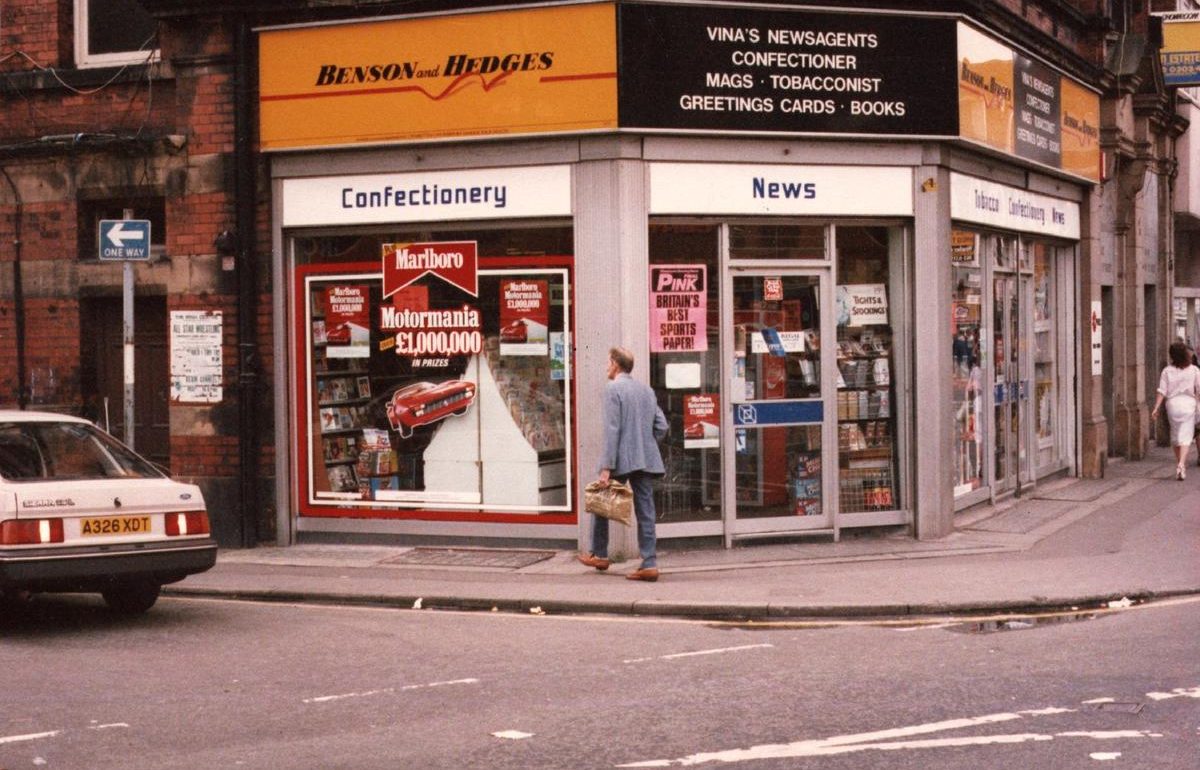
Image 1: 1986
Now home to the Milano Barbershop, the corner unit between Spear Street and Hilton Street was Vina’s Newsagents – notice the cigarette advertising and old-school posters. In 1986 Manchester, the GMEX had just opened, Sir Alex Ferguson took over at Manchester United and The Smiths released their pivotal third studio album The Queen Is Dead.
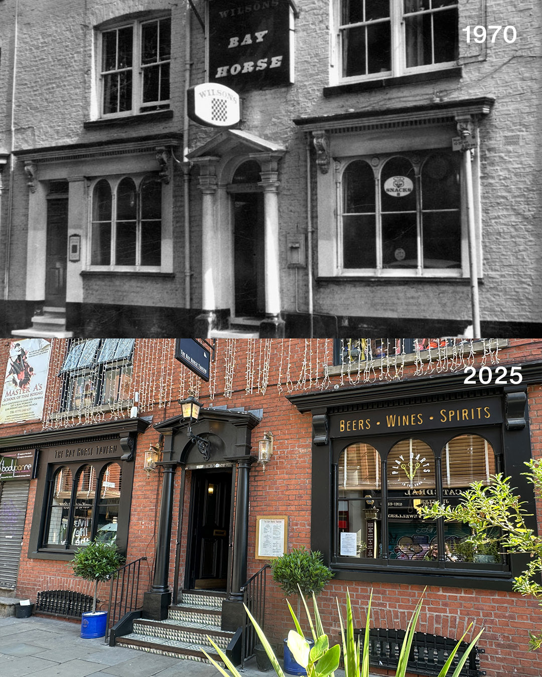
Image 2: 1970
The Bay Horse Tavern – the home of many post-work nights out. It’s been here pretty much since the birth of the Northern Quarter, first as The New Inn and then The Bay Horse Hotel before settling on its current name in the mid 19th century. What a boozer.
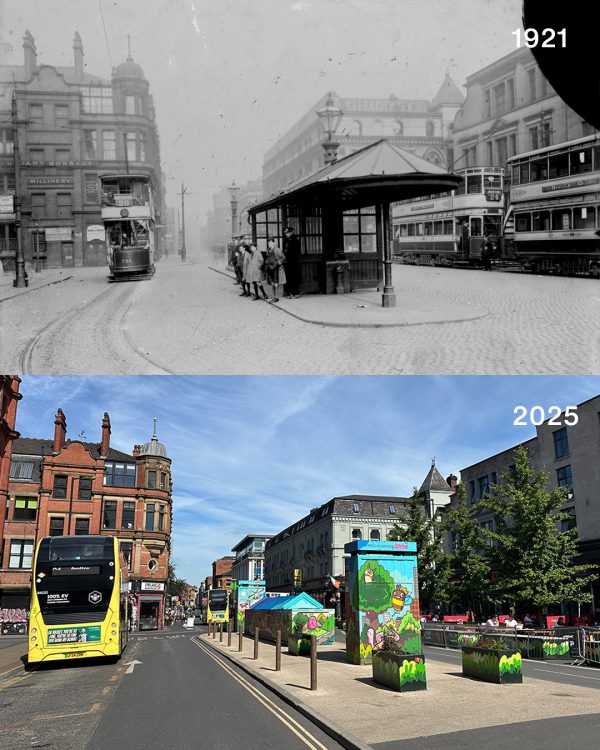
Image courtesy of Manchester Libraries
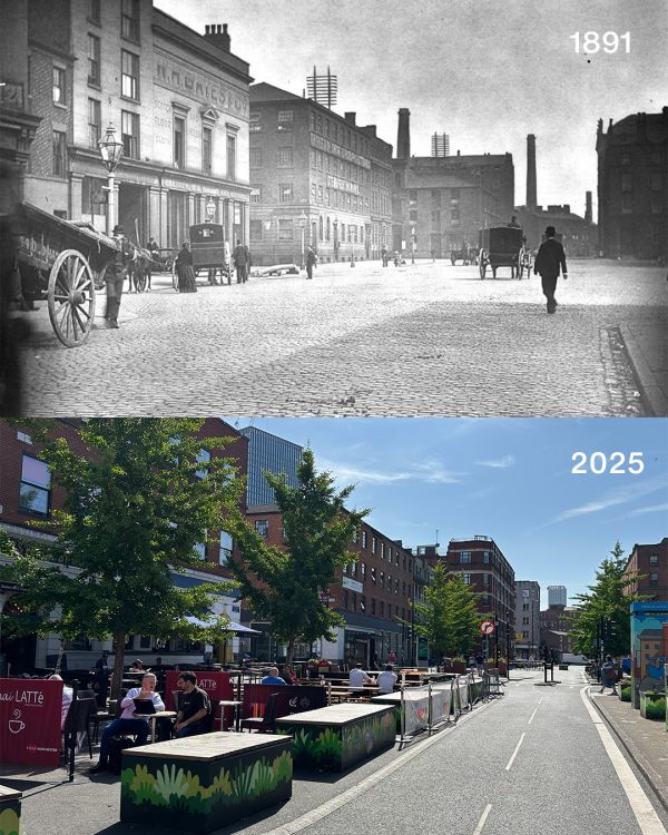
Image courtesy of Manchester Libraries
Image 3 & 4: 1921
Gas lamps, cobbled streets and the old trams. Manchester, like the rest of the country, had suffered huge losses during the First World War.
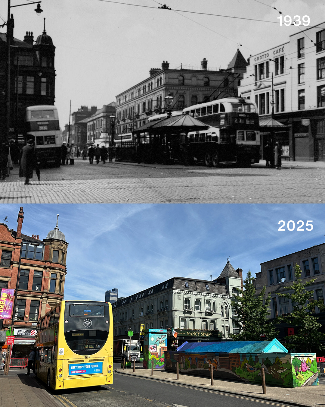
Image 5: 1939
Stevenson Square on the eve of war. It’s hard to believe that when this photo was taken, the whole world was about to change again. Looking from Lever Street, you can see the old public toilets in the centre, with the area around it used as a bus terminal.
